Latin America stands at a pivotal crossroads in forest carbon monitoring. The region is home to some of the most carbon-rich—and most vulnerable—forests in the world. Yet the systems in place to track and protect these forests often fall short, leaving policymakers and project developers to work with outdated or incomplete information.
Nota de prensa publicada por:
Today, decisions around land use, forest finance, and commodity production hinge on accurate, timely data. Carbon credit projects, particularly those under the REDD+ framework, depend on highly accurate measurements for avoided deforestation and associated carbon savings. Meanwhile, upcoming regulations, such as the EU Deforestation Regulation (EUDR), are pushing commodity producers and exporters to prove that their supply chains are not linked to illegal or unsustainable land use.
Fortunately, carbon monitoring technology is evolving to support both needs.
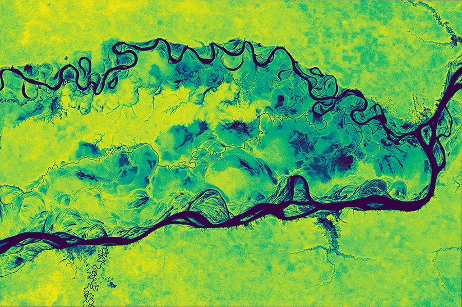
Earth observation company, Planet, launched the Forest Carbon Monitoring data product for mapping forest change at high resolution at the Summit of the Future and Climate Week NYC last fall. Built using data from Planet’s fleet of Dove satellites—the largest constellation of Earth-imaging satellites in the world—Forest Carbon Monitoring provides quarterly image updates (near 3M resolution) on canopy height, canopy cover, and aboveground carbon density. with a back catalog of images to December 2020.
At this resolution, the dataset detects the nuanced, diffuse patterns that most other tools miss: selective logging, degradation, and regrowth. These subtle forms of change are often invisible in coarser-resolution datasets but can account for major shifts in carbon storage.
The product also supports reforestation tracking, capturing sapling growth and forest regeneration at stages where field visits were once the only option. That kind of visibility makes it easier to monitor progress, reduce costs, and improve reporting confidence across large areas.
Planet recommends analyzing carbon data at the plot or jurisdiction level, not individual pixels. That’s because pixel-level estimates can vary too much to be reliable on their own. But when data is aggregated, it produces more accurate, statistically sound insights, well-suited to how carbon is measured in both project-level and national reporting.
This kind of operational, science-grade monitoring could play a key role in strengthening forest management, attracting climate finance, and complying with emerging trade standards. As demands for transparency grow, forest-rich nations need tools that offer precision, transparency, and operational scale.
Carbon sequestration by the biosphere remains one of the most powerful and cost-effective levers for climate mitigation—and forests are the backbone of that strategy. Tools that help protect and manage them are essential infrastructure for the climate economy.
Acerca de su empresa
Planet was founded with the mission to image the Earth every day and make change visible, accessible, and actionable. Over the past decade with our customers, Planet has revolutionized the Earth observation industry, democratizing access to satellite data beyond the traditional agriculture and defense sectors.